
40 Patriots Point Rd
Mount Pleasant, South Carolina, 29464
Commute to Downtown James Island
Almost all errands require a car.
Minimal bike infrastructure.

40 Patriots Point Rd has a Walk Score of 22 out of 100. This location is a Car-Dependent neighborhood so almost all errands require a car.
This location is in Mount Pleasant. Nearby parks include Mt Pleasant Pier Playground, Mt Pleasant Visitor Center and Charles Pinckney National Historic Site.

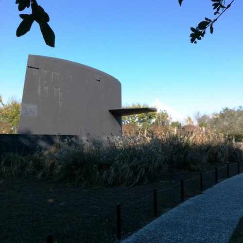
Memorial to the Cold War. I love walking around this due to the view of the bridge in the background. Nice sidewalks and trails in the area!
Explore how far you can travel by car, bus, bike and foot from 40 Patriots Point Rd.
Bus lines:
41 Coleman Blvd
0.6 mi
40 Mt. Pleasant
0.9 mi
210 CofC / Aquarium - DASH Shuttle
1.1 mi
211 Meeting/King - DASH
1.2 mi
This location is in the city of Mount Pleasant, SC. Mount Pleasant has an average Walk Score of 22 and has 67,843 residents.

Brickyard Plantation Property, Brickyard Parkway, Mount Pleasant, SC
Shem Creek Pier
Mt Pleasant Pier, Harry M. Hallman, Junior Boulevard, Mount Pleasant, SC
If you are using a screen reader or having trouble reading this website, please call Walk Score customer service at (253) 256-1634.
© 2026 Walk Score
Stacy SC