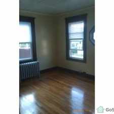
66 Clarence Street
West Springfield Town, Massachusetts, 01089
Commute to Downtown West Springfield Town
Almost all errands require a car.
Score Details
66 Clarence Street has a Walk Score of 24 out of 100. This location is a Car-Dependent neighborhood so almost all errands require a car.
This location is in West Springfield Town. Nearby parks include Veterans Field, Veterans Field and Mittineague Park.
Nearby schools include St Thomas The Apostle School, West Springfield High School and Mittineague Elementary School.
The closest grocery store is Spices of Asia.
Nearby coffee shops include Dunkin' Donuts, Hackett surv and Dunkin' Donuts. Nearby restaurants include Sorrento Pizza & Grinders, Village Pizza and Gold Chopstick.
66 Clarence Street is near Veterans Field, Land Off Dewey & Bear Hole Rd and Land Off Dewey & Bear Hole Rd.
Explore how far you can travel by car, bus, bike and foot from 66 Clarence Street.
Bus lines:
R10 Westfield State University / West Springfield
0.4 mi
View all West Springfield Town apartments on a map.

This location is in the city of West Springfield Town, MA. West Springfield Town has an average Walk Score of 33 and has 28,391 residents.
Learn More About West Springfield Town


If you are using a screen reader or having trouble reading this website, please call Walk Score customer service at (253) 256-1634.
© 2026 Walk Score