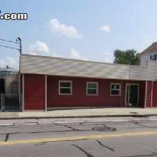
67 Hines Farm Road
Most errands require a car.
It is possible to get on a bus.
Score Details
67 Hines Farm Road has a Walk Score of 25 out of 100. This location is a Car-Dependent neighborhood so most errands require a car.
This location is in Cranston. Nearby parks include Oak Lawn Village Historic District, Troop C Park (historical) and Meshanticut State Park.
Explore how far you can travel by car, bus, bike and foot from 67 Hines Farm Road.
67 Hines Farm Road has minimal transit which means it is possible to get on a bus.
Bus lines:
30 Arlington/Oaklawn
0.6 mi
View all Cranston apartments on a map.

Popular apartment searches include hardwood floor, fitness and single family.
This location is in the city of Cranston, RI. Cranston has an average Walk Score of 48 and has 80,387 residents.
Learn More About Cranston


If you are using a screen reader or having trouble reading this website, please call Walk Score customer service at (253) 256-1634.
© 2026 Walk Score