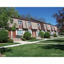
87 Harris Lane

Most errands require a car.

A few nearby public transportation options.

Flat as a pancake, minimal bike lanes.
About your score
87 Harris Lane has a Walk Score of 39 out of 100. This location is a Car-Dependent neighborhood so most errands require a car.
This location is in the Rossville neighborhood in New York. Nearby parks include Clay Pit Ponds State Park Preserve, Lemon Creek - Sandy Brook Bluebelt and Lemon Creek - Sandy Brook Bluebelt.
Explore how far you can travel by car, bus, bike and foot from 87 Harris Lane.
87 Harris Lane has some transit which means a few nearby public transportation options. Car sharing is available from RelayRides.
Rail lines:
SIR Staten Island Railway
1.4 mi
Bus lines:
S55 Rossville - Staten Island Mall
0.1 mi
S74 St. George - Bricktown Mall
0.1 mi
S84 St. George - Bricktown Mall LTD
0.1 mi
X22 Staten Island - Manhattan Express
0.3 mi
X17 Staten Island - Manhattan Express
0.3 mi
Car shares:
87 Harris Lane is in the Rossville neighborhood. Rossville is the 225th most walkable neighborhood in New York with a neighborhood Walk Score of 55.
Moving to New York from another city? View our moving to New York guide.




If you are using a screen reader or having trouble reading this website, please call Walk Score customer service at (253) 256-1634.
© 2026 Walk Score