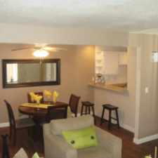
9152 Worsley Park Place
Most errands require a car.
It is possible to get on a bus.
Flat as a pancake, excellent bike lanes.
Score Details
9152 Worsley Park Place has a Walk Score of 33 out of 100. This location is a Car-Dependent neighborhood so most errands require a car.
This location is in the The Lakes neighborhood in Las Vegas. Nearby parks include Angel Park and Trent Park.
Nearby schools include Merryhill School At Peccole Ranch, Clarence Piggott Elementary School and Walter Jacobson Elementary School.
The closest grocery stores are fresh52, Whole Foods Market and Smith's.
Nearby coffee shops include Cafe Leone, The Crêpe and Pizza Lounge. Nearby restaurants include St Tropez Buffet, T.G.I. Friday's and suncoasts cafe siena.
9152 Worsley Park Place is near Canyon Fairways Community Park, Angel Park and Ansan Sister City Park.
There are excellent bike lanes and the terrain is flat as a pancake. 9152 Worsley Park Place is bikeable, there is some bike infrastructure.
Explore how far you can travel by car, bus, bike and foot from 9152 Worsley Park Place.
Bus lines:
WAX Westcliff Airport Express
0.4 mi
206 Charleston
0.4 mi
SX SX -Sahara Express
0.7 mi
120 Buffalo/Fort Apache
0.7 mi
207 Alta/Stewart
1.0 mi
Car shares:
View all The Lakes apartments on a map.

Popular apartment searches include fireplace, pool and fitness.
9152 Worsley Park Place is in the The Lakes neighborhood. The Lakes is the 18th most walkable neighborhood in Las Vegas with a neighborhood Walk Score of 37.
Moving to Las Vegas from another city? View our moving to Las Vegas guide.


If you are using a screen reader or having trouble reading this website, please call Walk Score customer service at (253) 256-1634.
© 2026 Walk Score