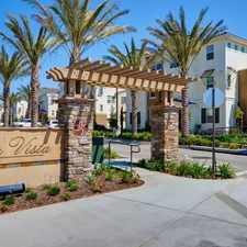
1035 Parsons Landing
Ocean Crest, San Diego, 92154
Commute to Downtown Chula Vista

Almost all errands require a car.

It is possible to get on a bus.

Very steep hills, minimal bike lanes.
About your score
1035 Parsons Landing has a Walk Score of 5 out of 100. This location is a Car-Dependent neighborhood so almost all errands require a car.
This location is in the Ocean Crest neighborhood in San Diego. Nearby parks include Palm Ridge Park and Pacific Gateway Park.
Explore how far you can travel by car, bus, bike and foot from 1035 Parsons Landing.
1035 Parsons Landing has minimal transit which means it is possible to get on a bus. Car sharing is available from RelayRides.
Bus lines:
934 Iris Trolley Loop - Imperial Beach Clockwise
0.8 mi
933 Iris Trolley Loop - Imperial Beach Counterclock
0.8 mi
905 Iris Trolley to Otay Mesa Border
1.0 mi
703 H St - Otay via Hilltop-Melrose/Main-E. Palomar
1.2 mi
704 E St Transit Center - Palomar Transit Center
1.2 mi
Car shares:
View all Ocean Crest apartments on a map.

1035 Parsons Landing is in the Ocean Crest neighborhood. Ocean Crest is the 103rd most walkable neighborhood in San Diego with a neighborhood Walk Score of 21.
Moving to San Diego from another city? View our moving to San Diego guide.




If you are using a screen reader or having trouble reading this website, please call Walk Score customer service at (253) 256-1634.
© 2026 Walk Score