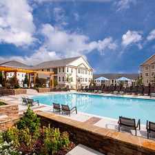
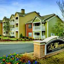
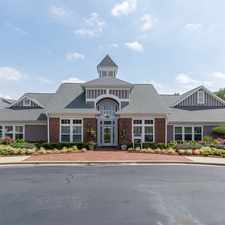
133 Hunt Club Lane
Raleigh, North Carolina, 27606
Commute to Downtown Raleigh
Most errands require a car.
A few nearby public transportation options.
Mostly flat, some bike lanes.
About your score
133 Hunt Club Lane has a Walk Score of 46 out of 100. This location is a Car-Dependent neighborhood so most errands require a car.
This location is in Raleigh. Nearby parks include Powell Drive Park, Buck Jones Open Space and Kaplan Park.
Explore how far you can travel by car, bus, bike and foot from 133 Hunt Club Lane.
133 Hunt Club Lane has some transit which means a few nearby public transportation options. Car sharing is available from RelayRides.
Bus lines:
11L Buck Jones Connector
0.1 mi
301 Raleigh-Cary-RTC
0.1 mi
300 Cary-Raleigh
0.1 mi
305 Lake Pine-Cary-Raleigh
0.1 mi
6 CTRAN - Buck Jones Road
0.2 mi
Car shares:
133 Hunt Club Lane compared to all of Raleigh.
Lower crime area.
Average crime area.
How do you feel walking near 133 Hunt Club Lane?
Day:
Night:
Thanks for your feedback!
This location is in the city of Raleigh, NC. Raleigh has an average Walk Score of 30 and has 403,892 residents.

Nash Square
Sitti
Raleigh City Farm

If you are using a screen reader or having trouble reading this website, please call Walk Score customer service at (253) 256-1634.
© 2024 Walk Score