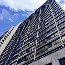
Rockcliffe-Smythe, Toronto, M6N 4X6
Commute to Downtown Toronto
Most errands require a car.
Many nearby public transportation options.
Flat as a pancake, excellent bike lanes.
About your score
This location has a Walk Score of 42 out of 100. This location is a Car-Dependent neighborhood so most errands require a car.
This location is in the Rockcliffe-Smythe neighborhood in Toronto. Nearby parks include Scarlett Mills Park, James Gardens and Scarlett Heights Park.
Explore how far you can travel by car, bus, bike and foot from this location.
This location has good transit which means many nearby public transportation options. Car sharing is available from Zipcar.
Bus lines:
79 SCARLETT RD.
0.1 km
32 EGLINTON WEST
0.9 km
332 EGLINTON WEST NIGHT BUS
0.9 km
335 JANE NIGHT BUS
0.9 km
35 JANE
0.9 km
Car shares:
This location is in the Rockcliffe-Smythe neighborhood. Rockcliffe-Smythe is the 109th most walkable neighborhood in Toronto with a neighborhood Walk Score of 61.


If you are using a screen reader or having trouble reading this website, please call Walk Score customer service at (253) 256-1634.
© 2025 Walk Score