Daily errands do not require a car.
Many nearby public transportation options.
Flat as a pancake, some bike lanes.
Score Details
This location has a Walk Score of 95 out of 100. This location is a Walker’s Paradise so daily errands do not require a car.
This location is a 10 minute walk from the BSS ATT Station to Fern Rock TC at the Ellsworth Federal Station stop.
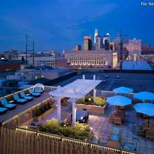
This location is in the Pennsport/Whitman/Queen neighborhood in Philadelphia. Nearby parks include Capitol Park Playgtound, Tomb of Unknown Soldier of Revolution (historical) and Passyunk Square.
Nearby schools include Nebinger George W School, Annunciation Bvm School and Washington George School.
The closest grocery stores are P&F Giordano's Fruit and Produce, Marie's Grocery and First Oriental Market Inc.
Nearby coffee shops include Fante's Kitchen Shop, Down Dog Healing Cafe and Anthony's Chocolate House. There are 234 restaurants within a 15 minute walk including Iannelli Bakery, Geno's Steaks and Taquería Los Taquitos de Puebla.
This location is near Passyunk Square, Jefferson Square and Cianfrani Park.
There are some bike lanes and the terrain is flat as a pancake. This location is very bikeable, biking is convenient for most trips.
Explore how far you can travel by car, bus, bike and foot from this location.
This location has good transit which means many nearby public transportation options. Car sharing is available from Zipcar and RelayRides.
Rail lines:
BSS ATT Station to Fern Rock TC
0.5 mi
MFL Frankford TC to 69th St TC
1.2 mi
Chestnut Hill West Line Chestnut Hill West Line
1.3 mi
Media/Elwyn Line Media/Elwyn Line
1.3 mi
Chestnut Hill East Line Chestnut Hill East Line
1.3 mi
Lansdale/Doylestown Line Lansdale/Doylestown Line
1.3 mi
Trenton Line Trenton Line
1.3 mi
Warminster Line Warminster Line
1.3 mi
Airport Line Airport Line
1.3 mi
West Trenton Line West Trenton Line
1.3 mi
Bus lines:
47 Whitman Plaza to 5th-Godfrey
0.0 mi
47M Whitman Plaza to Spg Grd via 9th St
0.1 mi
64 50th-Parkside to Pier 70
0.1 mi
61 9th-Market to Manayunk
1.2 mi
62 9th-Market to Andorra
1.2 mi
Car shares:
This location compared to all of Philadelphia.
Lower crime area.
Lower crime area.
How do you feel walking near this location?
Day:
Night:
Thanks for your feedback!
This location is in the Pennsport/Whitman/Queen neighborhood. Pennsport/Whitman/Queen is the 6th most walkable neighborhood in Philadelphia with a neighborhood Walk Score of 91.
Moving to Philadelphia from another city? View our moving to Philadelphia guide.

Bizarre Bazaar, 720 South 5th Street, Philadelphia, PA
Graffiti Art
Mifflin Square


If you are using a screen reader or having trouble reading this website, please call Walk Score customer service at (253) 256-1634.
© 2024 Walk Score