16547 Park Lane Circle
Almost all errands require a car.
It is possible to get on a bus.
Very steep hills, minimal bike lanes.
Score Details
16547 Park Lane Circle has a Walk Score of 3 out of 100. This location is a Car-Dependent neighborhood so almost all errands require a car.
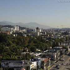
This location is in the Brentwood neighborhood in Los Angeles.
Explore how far you can travel by car, bus, bike and foot from 16547 Park Lane Circle.
16547 Park Lane Circle has minimal transit which means it is possible to get on a bus. Car sharing is available from RelayRides.
Bus lines:
734 Metro Rapid Line
0.8 mi
234 Metro Local Line
0.8 mi
Car shares:
16547 Park Lane Circle compared to all of Los Angeles.
Lowest crime area.
Lower crime area.
How do you feel walking near 16547 Park Lane Circle?
Day:
Night:
Thanks for your feedback!
16547 Park Lane Circle is in the Brentwood neighborhood. Brentwood is the 70th most walkable neighborhood in Los Angeles with a neighborhood Walk Score of 50.
Moving to Los Angeles from another city? View our moving to Los Angeles guide.

Brentwood Village Farmers Market
11628 Montana Ave
11743 Darlington Ave

If you are using a screen reader or having trouble reading this website, please call Walk Score customer service at (253) 256-1634.
© 2024 Walk Score