Daily errands do not require a car.
World-class public transportation.
Flat as a pancake, excellent bike lanes.
Score Details
This location has a Walk Score of 95 out of 100. This location is a Walker’s Paradise so daily errands do not require a car.
This location is a two minute walk from the A 8 Avenue Express and the C 8 Avenue Local at the Franklin Av stop.
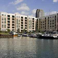
This location is in the Crown Heights neighborhood in New York. Nearby parks include Crispus Attucks Playground, Hancock Playground and Grant Gore Triangle.
Nearby schools include Nelrak Child Development Center, PS 3 Bedford Village School and Bethel Elementary School.
The closest grocery stores are Trade Wise Supermarket, Deli Grocery and Associated Supermarket.
Nearby coffee shops include Thirstbar Inc, Dunkin' Donuts and Daily Press Bed-Stuy. There are 197 restaurants within a 15 minute walk including Brooklyn Wine Yard, Rowe's Restaurant and Lucky Family Takeout Kitchen.
This location is near Putnam Plaza, Lowry Triangle and Prospect Heights Community Farm.
There are excellent bike lanes and the terrain is flat as a pancake. This location is very bikeable, biking is convenient for most trips. Bike sharing is available from Citi Bike.
Explore how far you can travel by car, bus, bike and foot from this location.
This location is a Rider’s Paradise which means world-class public transportation. Car sharing is available from Zipcar, RelayRides and Enterprise CarShare.
Rail lines:
C 8 Avenue Local
0.1 mi
A 8 Avenue Express
0.1 mi
S Franklin Avenue Shuttle
0.1 mi
West Hempstead
0.5 mi
Babylon
0.5 mi
Hempstead
0.5 mi
Ronkonkoma
0.5 mi
City Zone
0.5 mi
Long Beach
0.5 mi
Far Rockaway
0.5 mi
Bus lines:
B48 Lefferts Gardens - Greenpoint
0.1 mi
B49 Manhattan Beach - Bedford-Stuyvesant
0.1 mi
B25 Dwntn Bklyn & DUMBO - Broadway Junction
0.1 mi
B65 Downtown Brooklyn - Crown Heights
0.2 mi
B26 Downtown Brooklyn - Ridgewood
0.2 mi
B44 Sheepshead Bay - Williamsburg
0.2 mi
B44-SBS Sheepshead Bay - Williamsburg
0.2 mi
Car shares:
Bike shares:
This location is in the Crown Heights neighborhood. Crown Heights is the 56th most walkable neighborhood in New York with a neighborhood Walk Score of 94.
Moving to New York from another city? View our moving to New York guide.

7 Crown Heights: Crown Heights Wall
Crown Heights 2: Lincoln Terrace Park
8 Crown Heights: Brooklyn Public Library


If you are using a screen reader or having trouble reading this website, please call Walk Score customer service at (253) 256-1634.
© 2024 Walk Score