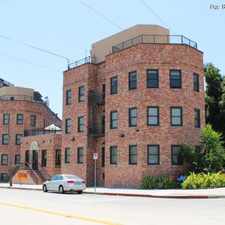
655 South Soto Street
Most errands can be accomplished on foot.
Transit is convenient for most trips.
Flat as a pancake, minimal bike lanes.
Score Details
655 South Soto Street has a Walk Score of 79 out of 100. This location is Very Walkable so most errands can be accomplished on foot.
This location is in the Boyle Heights neighborhood in Los Angeles. Nearby parks include Boyle Heights Sports Center Park, Hollenbeck Park and Boyle Heights Recreation Center.
Explore how far you can travel by car, bus, bike and foot from 655 South Soto Street.
655 South Soto Street has excellent transit which means transit is convenient for most trips. Car sharing is available from RelayRides.
Rail lines:
Metro Gold Line (804)
0.6 mi
Bus lines:
252 Metro Local Line
0.1 mi
251 Metro Local Line
0.1 mi
620 Metro Local Line
0.1 mi
18 Metro Local Line
0.1 mi
720 Metro Rapid Line
0.1 mi
751 Metro Rapid Line
0.1 mi
62 Metro Local Line
0.3 mi
Car shares:
655 South Soto Street compared to all of Los Angeles.
Lower crime area.
Lower crime area.
How do you feel walking near 655 South Soto Street?
Day:
Night:
Thanks for your feedback!
655 South Soto Street is in the Boyle Heights neighborhood. Boyle Heights is the 18th most walkable neighborhood in Los Angeles with a neighborhood Walk Score of 77.
Moving to Los Angeles from another city? View our moving to Los Angeles guide.

Mariachi Plaza / Boyle Heights Station
Mariachi Plaza / Boyle Heights Station
200 S Pecan St


If you are using a screen reader or having trouble reading this website, please call Walk Score customer service at (253) 256-1634.
© 2024 Walk Score