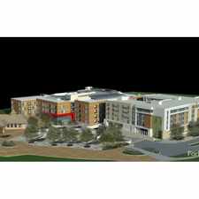
White Rock Circle
Most errands require a car.
A few nearby public transportation options.
Flat as a pancake, excellent bike lanes.
Score Details
White Rock Circle has a Walk Score of 26 out of 100. This location is a Car-Dependent neighborhood so most errands require a car.
This location is in Boulder.
Explore how far you can travel by car, bus, bike and foot from White Rock Circle.
White Rock Circle has some transit which means a few nearby public transportation options. Car sharing is available from RelayRides.
Bus lines:
205T 205T 28th St / Gunbarrel / Heatherwood
0.2 mi
J Longmont / East Boulder / CU
0.2 mi
205 28th St / Gunbarrel / Heatherwood
0.3 mi
Car shares:
This location is in the city of Boulder, CO. Boulder has an average Walk Score of 56 and has 97,385 residents.

Tahona Tequila Bistro
Sanitas Trailhead
Foolish Craig's Cafe


If you are using a screen reader or having trouble reading this website, please call Walk Score customer service at (253) 256-1634.
© 2024 Walk Score