Walk Score Logo
Go
Locate me

Living in Beverly Hills

Beverly Hills has an average Walk Score of 75 with 34,109 residents.

Beverly Hills has good public transportation and is somewhat bikeable.

The most walkable Beverly Hills ZIP codes are 90211 and 90212.

Nearby Beverly Hills Apartments on Redfin

75 Walk Score of Beverly Hills, CA

Beverly Hills is Very Walkable

Most errands can be accomplished on foot.

Walk Score Map

25
100
Photo of Brighten Coffee Shop in Beverly Hills

Brighten Coffee Shop

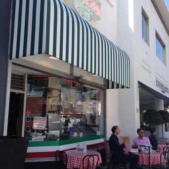
Photo of Il Pastaio in Beverly Hills

Il Pastaio

Beverly Hills has an average Walk Score of 75 with 34,109 residents.

Beverly Hills has good public transportation and is somewhat bikeable.

Find apartments in Beverly Hills's most walkable ZIP codes: 90211 and 90212.

Beverly Hills Apartments for Rent

Beverly Hills Neighborhoods

Rank

#

Name

Walk Score

Transit Score

Bike Score

Population

1 90211 87 - - 8,462
2 90212 87 - - 11,605
55 Transit Score of Beverly Hills, CA

Beverly Hills has Good Transit

Many nearby public transportation options. Find Beverly Hills apartments for rent on Redfin.

Public Transit Routes

Beverly Hills has good public transportation and about 6 bus lines.

Transit Time

The map above shows how far you can travel in 30 minutes from Beverly Hills on public transit.

Neighborhood Guides

Thinking of renting an apartment or buying in Beverly Hills? Ask our neighborhood guides a question.

RealEstateArchitect

Professional real estate brokerage, guidance and service matching distinguished properties with a discerning clientele.

Ask RealEstateArchitect about Beverly Hills

http://www.RealEstateArchitect.com »

Photo of Brighten Coffee Shop in Beverly Hills

Brighten Coffee Shop

Photo of Brooks Brothers in Beverly Hills

Brooks Brothers

Photo of Christophle in Beverly Hills

Christophle

Matthew Gaskill

Real estate professional with Sotheby's and amateur short story writer. Flâneur. | CalBRE# 01934613

Ask Matthew about Beverly Hills

http://www.luxuryhomeslosangeles.com »

Photo of Il Pastaio in Beverly Hills

Il Pastaio

Photo of Via Alloro in Beverly Hills

Via Alloro

Photo of Mulberry Street Pizzeria in Beverly Hills

Mulberry Street Pizzeria

52 Bike Score of Beverly Hills, CA

Beverly Hills is Bikeable

Some bike infrastructure.

25
100
Bike
Score

     o__
    _.>/ _
___(_)_\(_)___
          
Bike
Lanes

________________
 __  __  __  __
________________
          
Hills
          _
         / \
   _   _/   \
__/ \_/      \__
          
Bike
Commuters
              _
             |_|
/\           |_|
[]...........|_|
          

Photo of Mulberry Street Pizzeria in Beverly Hills

Mulberry Street Pizzeria

Photo of Brooks Brothers in Beverly Hills

Brooks Brothers

Photo of Christophle in Beverly Hills

Christophle

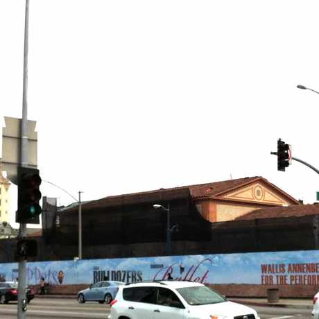
Photo of Wallis Annenberg Center for the Performing Arts in Beverly Hills

Wallis Annenberg Center for the Performing Arts

Photo of Beverly Gardens Park in Beverly Hills

Beverly Gardens Park

Photo of Jack Colker's 76 Service Station in Beverly Hills

Jack Colker's 76 Service Station

Photo of 625.000 in Beverly Hills

625.000

Photo of 649.000 in Beverly Hills

649.000

Photo of 599.000 in Beverly Hills

599.000

Photo of 569.000 in Beverly Hills

569.000

Beverly Hills is Talking About...

beverly center holly wood coffee hotel food car drink play abbey food & bar west hollywood lunch dinner weho music los angeles movie party california rodeo drive eat

Beverly Hills is all about:

Tweet @WalkScore
Photo of Intermix in Beverly Hills

Intermix

Photo of The Paley Center for Media in Beverly Hills

The Paley Center for Media

Photo of CHANEL in Beverly Hills

CHANEL

Photo of Salon No9 in Beverly Hills

Salon No9

Walk Score Professional

Real Estate

Walk Score Neighborhood Map

Add Walk Score, Bike Score, and Transit Score to your rental and for sale properties with the Walk Score Widget.

Software Developers

Walk Score APIs

Build apps with Walk Score, public transit data, and commute and travel times via Walk Score APIs.

Data and Analysis

Walk Score Data and Research

Use Walk Score data for real estate, public health, finance, and urban planning research and analysis.