Walk Score Logo
Go
Locate me

Living in Topeka

Topeka has an average Walk Score of 37 with 127,473 residents.

Topeka has minimal public transportation and is somewhat bikeable.

The most walkable Topeka neighborhoods are Tennessee Town, Old Town and Elmhurst.

Nearby Topeka Apartments on Redfin

37 Walk Score of Topeka, KS

Topeka is a Car-Dependent city

Most errands require a car.

Walk Score Map

25
100
Photo of Topeka High School in Topeka

Topeka High School

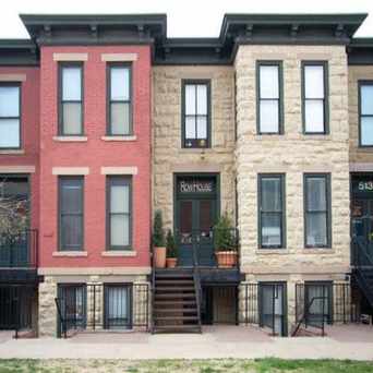
Photo of Rowhouse Restaurant in Topeka

Rowhouse Restaurant

Most errands require a car in Topeka.

Topeka Apartments for Rent

Topeka Neighborhoods

Rank

#

Name

Walk Score

Transit Score

Bike Score

Population

1 Tennessee Town 71 32 75 634
2 Old Town 71 36 83 2,295
3 Elmhurst 69 30 72 1,040
4 Historic Holiday Park North 67 37 80 1,037
5 College Hill 64 30 72 1,512
6 Westboro 63 28 57 807
7 West Meade 60 32 77 2,483
8 Central Park 60 33 69 2,634
9 Norton 59 29 68 636
10 McAlister Parkway 57 28 54 756
11 Chesney Park 57 31 72 1,444
12 Central Topeka 54 28 66 5,094
13 Downtown 52 41 78 1,298
14 Monroe 52 37 82 1,089
15 Randolph 51 28 65 1,598
16 Kenwood 49 24 64 633
17 Oakland 45 18 46 5,650
18 North Topeka East 44 23 67 3,096
19 Quinton Heights 42 26 56 726
20 Greater Auburndale 41 25 54 1,482
21 East Topeka North 39 28 77 2,764
22 Central Highland Park 36 25 44 5,556
23 East Topeka South 29 30 60 2,867
24 Jefferson Square 29 27 41 685
25 East Topeka 26 17 39 3,070
26 Highland Crest 24 25 50 5,375
27 North Topeka West 21 20 61 2,707
28 East End 18 23 30 1,965

thumbnail for Rowhouse RestaurantThis is such a cool block in Topeka. When I lived in Topeka I never really noticed it, but these row houses are fantastic urban architecture. Next time I'm in Topeka I'd love to eat at this restaurant!

Matt L
on Rowhouse Restaurant

23 Transit Score of Topeka, KS

Topeka has Minimal Transit

It is possible to get on a bus. Find Topeka apartments for rent on Redfin.
Public Transit Routes

Topeka has minimal public transportation and about 12 bus lines.

Transit Time

The map above shows how far you can travel in 30 minutes from Topeka on public transit.

Neighborhood Guides

Thinking of renting an apartment or buying in Topeka? Ask our neighborhood guides a question.

Photo of Westboro Shopping Center in Topeka

Westboro Shopping Center

Photo of Great Mural Wall in Topeka

Great Mural Wall

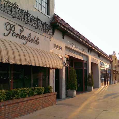
Photo of Porterfield's Flowers in Topeka

Porterfield's Flowers

54 Bike Score of Topeka, KS

Topeka is Bikeable

Some bike infrastructure.

25
100
Bike
Score

     o__
    _.>/ _
___(_)_\(_)___
          
Bike
Lanes

________________
 __  __  __  __
________________
          
Hills
          _
         / \
   _   _/   \
__/ \_/      \__
          
Bike
Commuters
              _
             |_|
/\           |_|
[]...........|_|
          

Photo of Westboro Shopping Center in Topeka

Westboro Shopping Center

Photo of Whitson Elementary School in Topeka

Whitson Elementary School

Photo of Great Mural Wall in Topeka

Great Mural Wall

Photo of Porterfield's Flowers in Topeka

Porterfield's Flowers

Photo of College Hill Apartments in Topeka

College Hill Apartments

Photo of The Library Foundation in Topeka

The Library Foundation

Topeka is Talking About...

play kansas run god song food car drink money school walk job my life sleep movie party team tired eat dream

Topeka is all about:

Tweet @WalkScore

Walk Score Professional

Real Estate

Walk Score Neighborhood Map

Add Walk Score, Bike Score, and Transit Score to your rental and for sale properties with the Walk Score Widget.

Software Developers

Walk Score APIs

Build apps with Walk Score, public transit data, and commute and travel times via Walk Score APIs.

Data and Analysis

Walk Score Data and Research

Use Walk Score data for real estate, public health, finance, and urban planning research and analysis.