Walk Score Logo
Go
Locate me

Living in Cincinnati

Cincinnati’s remarkable historic architecture once earned it the nickname of the “Paris of America.” The city’s Over the Rhine neighborhood is still home to spectacular landmark buildings, some of which have been converted in to luxury apartments.

Metro runs bus service in the city, across the river to Covington, Kentucky, and an express line runs from downtown to Kenwood, to the north. The historic Andersen Ferry makes a short trip across the river to Hebron, Kentucky, a few times daily. The Cincinnati Bike Center provides secure parking for downtown bicycle commuters at Smale Riverfront Park.

Nearby Cincinnati Apartments on Redfin

49 Walk Score of Cincinnati, OH

Cincinnati is a Car-Dependent city

Most errands require a car.

Walk Score Map

25
100
Photo of Anderson Farmers' Market in Cincinnati

Anderson Farmers' Market

Photo of Matthew O'Brien Diggs II Plaza in Cincinnati

Matthew O'Brien Diggs II Plaza

Cincinnati has an average Walk Score of 49 with 296,943 residents.

Cincinnati has some public transportation and does not have many bike lanes.

Find apartments in Cincinnati's most walkable neighborhoods: Over-The Rhine, Central Business District and Corryville.

Cincinnati Apartments for Rent

Cincinnati Neighborhoods

Rank

#

Name

Walk Score

Transit Score

Bike Score

Population

1 Over-The Rhine 94 72 65 6,262
2 Central Business District 92 79 62 5,586
3 Corryville 84 58 44 3,370
4 CUF 82 56 50 6,078
5 Mount Auburn 78 64 41 4,994
6 West End 77 64 63 6,521
7 The Heights 74 57 50 9,845
8 Northside 67 47 49 6,775
9 Oakley 62 43 44 10,063
10 Walnut Hills 62 54 46 6,663
11 Clifton 60 49 45 9,286
12 Mount Adams 59 62 48 1,703
13 Hyde Park 59 42 46 12,457
14 Camp Washington 57 48 70 1,367
15 East Walnut HIlls 55 47 42 3,594
16 East Price Hill 54 39 25 12,648
17 Evanston 53 50 43 8,966
18 Madisonville 53 37 42 10,630
19 Lower Price Hill 53 44 42 618
20 West Price Hill 49 37 27 19,504
21 Bond Hill 48 43 45 8,028
22 Pleasant Ridge 48 40 28 9,012
23 Avondale 46 53 37 7,863
24 Roselawn 44 44 39 5,983
25 Mount Lookout 43 35 32 6,082
26 Columbia-Tusculum 43 27 36 2,164
27 Carthage 41 38 56 3,470
28 Hartwell 38 30 36 5,395
29 South Cumminsville 38 44 39 1,288
30 Kennedy Heights 38 40 28 5,361
31 Winton Place 38 40 31 2,185
32 Westwood 37 42 22 30,387
33 East End 35 30 52 712
34 Mount Washington 35 27 26 11,559
35 College Hill 35 39 30 14,237
36 North Avondale 32 47 37 6,811
37 Paddock Hills 30 45 24 1,814
38 Millvale 28 40 29 929
39 Sayler Park 26 27 21 3,170
40 Linwood 25 29 43 963
41 South Fairmont 22 41 13 3,335
42 Mount Airy 22 39 16 8,951
43 Winton Hills 18 39 18 5,322
44 English Woods 14 42 17 604
45 North Fairmount 10 43 12 1,209
46 Riverside 10 16 6 1,888
47 East Westwood 9 39 9 4,816

Average Home Features

According to HomeAdvisor Data, these characteristics make up the average home in Cincinnati

Average square footage 2100
Homeowners have 3.3 bedrooms
Homeowners have 2.3 bathrooms
Age of home 44 years
Average time living in home 12 years

Check out HomeAdvisor’s Cincinnati Home Happiness Survey.

thumbnail for Cincinnati Music HallHome of the Cincinnati Orchestra, Cincinnati Music Hall overlooks the newly redesigned Washington park

Stephen Davis
on Cincinnati Music Hall

44 Transit Score of Cincinnati, OH

Cincinnati has Some Transit

A few nearby public transportation options. Find Cincinnati apartments for rent on Redfin.

Public Transit Routes

Cincinnati has some public transportation and about 64 bus and 1 light rail lines.

Transit Time

The map above shows how far you can travel in 30 minutes from Cincinnati on public transit.

36 Bike Score of Cincinnati, OH

Cincinnati is Somewhat Bikeable

Minimal bike infrastructure.

25
100
Bike
Score

     o__
    _.>/ _
___(_)_\(_)___
          
Bike
Lanes

________________
 __  __  __  __
________________
          
Hills
          _
         / \
   _   _/   \
__/ \_/      \__
          
Bike
Commuters
              _
             |_|
/\           |_|
[]...........|_|
          

Photo of Coffee Emporium in Cincinnati

Coffee Emporium

Photo of Washington Park in Cincinnati

Washington Park

Photo of Dewey's Pizza in Cincinnati

Dewey's Pizza

Photo of Burnett Woods in Cincinnati

Burnett Woods

Photo of Burnett Woods in Cincinnati

Burnett Woods

Photo of Hopkins Park in Cincinnati

Hopkins Park

thumbnail for The Golden MuseA joint project between Artworks and the Taft Museum of Art "The Golden Muse"is a mural celebrating The Latter's 80th Anniversary. This overlooks Washington Park opposite the Cincinnati Music Hall.

Stephen Davis
on The Golden Muse

Photo of Hopkins Park in Cincinnati

Hopkins Park

Photo of Sycamore Hill Park in Cincinnati

Sycamore Hill Park

Photo of VINE ST & LIBERTY ST in Cincinnati

VINE ST & LIBERTY ST

Photo of RACE ST & LIBERTY ST in Cincinnati

RACE ST & LIBERTY ST

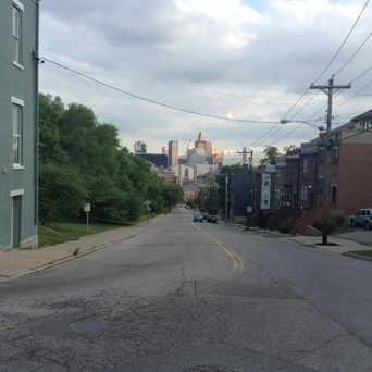
thumbnail for Bogart'sThis iconic place is a neighborhood staple. Bogarts theatre is a music venue that's seen some of the greatest a acts in the industry. Recently home to the yahoo music tour which has been doing a lot of free shows this year #corryville
Stephen Davis
on Bogart's

Cincinnati is Talking About...

school movie eating cincy coffee music money god class drink run job walk food beer sleep fountain square car party playing

Cincinnati is all about:

Tweet @WalkScore
Photo of Esquire Theatre in Cincinnati

Esquire Theatre

Photo of Ohio Historical Marker-Over The Rhine in Cincinnati

Ohio Historical Marker-Over The Rhine

thumbnail for Anderson Farmers' MarketAnderson Center is a venue for township's Jack-o-lantern walks, community meetings and Cincinnati Chamber Orchestra. Make sure to check out the bike path across the street.

Amandeep Sian
on Anderson Farmers' Market

Walk Score Professional

Real Estate

Walk Score Neighborhood Map

Add Walk Score, Bike Score, and Transit Score to your rental and for sale properties with the Walk Score Widget.

Software Developers

Walk Score APIs

Build apps with Walk Score, public transit data, and commute and travel times via Walk Score APIs.

Data and Analysis

Walk Score Data and Research

Use Walk Score data for real estate, public health, finance, and urban planning research and analysis.