


Search for apartments in Tulsa or check out apartments in other Tulsa neighborhoods. Links will open on our partner site Redfin.com.
- Barrington Hills, Tulsa apartments for rent
- Berryhill, Tulsa apartments for rent
- Brookside, Tulsa apartments for rent
- Downtown Tulsa, Tulsa apartments for rent
- Eastside Tulsa, Tulsa apartments for rent
- Florence Park, Tulsa apartments for rent
- Gilcrease Hills, Tulsa apartments for rent
- Greens at Broken Arrow, Tulsa apartments for rent
- Hawthrone, Tulsa apartments for rent
- Kendall-Whittier, Tulsa apartments for rent
- Maple Ridge Historic District, Tulsa apartments for rent
- Mid Tulsa, Tulsa apartments for rent
- Midtown, Tulsa apartments for rent
- North Maple Ridge, Tulsa apartments for rent
- Northside Tulsa, Tulsa apartments for rent
- Southside Tulsa, Tulsa apartments for rent
- Stone Canyon, Tulsa apartments for rent
- Utica Square, Tulsa apartments for rent
- West Highlands-Tulsa Hills, Tulsa apartments for rent
- Westside Tulsa, Tulsa apartments for rent


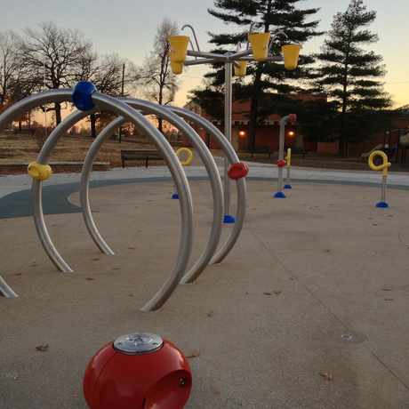

 This is a huge park. This park has a recreation center, pool, tennis and basketball courts, playground, swings. There are also soccer and baseball fields.


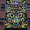 Psychedelic mural in the Blue Dome District downtown. #streetart


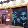 Downtown BBQ restaurant with a painted picture of The Blues Brothers on the front. #streetart


HulaMomma4
on Owen Park