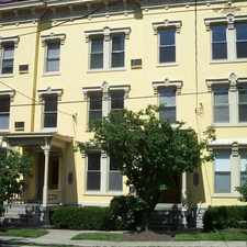
1433 East McMillan Street
East Walnut HIlls, Cincinnati, 45206
Commute to Downtown Cincinnati
Some errands can be accomplished on foot.
A few nearby public transportation options.
.

1433 East McMillan Street has a Walk Score of 64 out of 100. This location is Somewhat Walkable so some errands can be accomplished on foot.
This location is in the East Walnut HIlls neighborhood in Cincinnati. Nearby parks include Madison and Woodburn Historic District, Saint Francis De Sales Church Historic District and Chatfield Memorial.
Explore how far you can travel by car, bus, bike and foot from 1433 East McMillan Street.
1433 East McMillan Street has some transit which means a few nearby public transportation options.
Bus lines:
31 Crosstown - Queensgate - Evanston
0.0 mi
5164 Duck Creek - Golf Manor - Walnut
0.0 mi
3101 Clifton/McMillan - Mt Washington
0.1 mi
1131 Madison - Price Hill - Cheviot
0.1 mi
5122 Duck Creek - Walnut Hills - Madison
0.1 mi
4344 Seymour - Avondale - Walnut Hills
0.1 mi
3342 Ferguson - Walnut Hills - Evanston
0.1 mi
2431 Erie - Harrison - Glenway
0.1 mi
1152 Madison - Glenway - Montana
0.1 mi
2451 Erie - Price Hill - Cheviot
0.1 mi
1433 East McMillan Street is in the East Walnut HIlls neighborhood. East Walnut HIlls is the 14th most walkable neighborhood in Cincinnati with a neighborhood Walk Score of 57.


If you are using a screen reader or having trouble reading this website, please call Walk Score customer service at (253) 256-1634.
© 2024 Walk Score