
East West Highway
Some errands can be accomplished on foot.
Transit is convenient for most trips.
Some bike infrastructure.

East West Highway has a Walk Score of 66 out of 100. This location is Somewhat Walkable so some errands can be accomplished on foot.
East West Highway is a 16 minute walk from the Red Metrorail Red Line at the SILVER SPRING, RED LINE CENTER PLATFORM stop.
This location is in Silver Spring. Nearby parks include Beach Parkway, Rock Creek Stream Valley Park and North Portal.
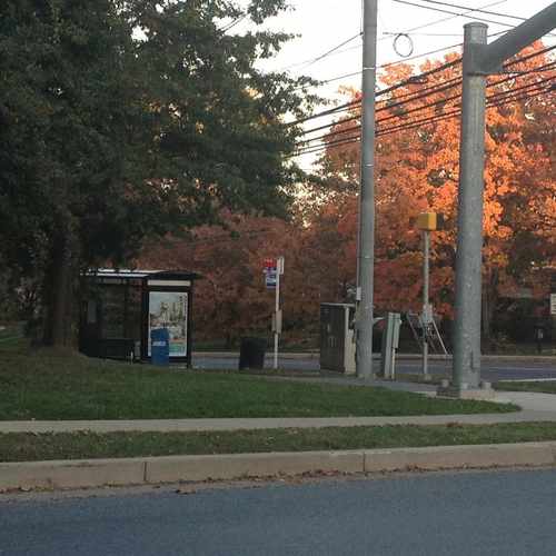
One of several bus lines connecting to the Red Line Metro stops in Friendship, Bethesda and Silver Spring
Explore how far you can travel by car, bus, bike and foot from East West Highway.
East West Highway has excellent transit which means transit is convenient for most trips.
Rail lines:
Red Metrorail Red Line
0.7 mi
MARC BRUNSWICK - WASHINGTON
0.8 mi
MARC BRUNSWICK - WASHINGTON
0.8 mi
Bus lines:
J1 BETHESDA-SILVER SPRING
0.0 mi
J2 BETHESDA-SILVER SPRING
0.0 mi
1 1-Silver Spring-Friendship Heights
0.0 mi
2 2-Silver Spring-Lyttonsville
0.0 mi
11 11-Silver Spring-Friendship Heights
0.0 mi
This location is in the city of Silver Spring, MD. Silver Spring has an average Walk Score of 63 and has 71,452 residents.
Learn More About Silver SpringIf you are using a screen reader or having trouble reading this website, please call Walk Score customer service at (253) 256-1634.
© 2024 Walk Score
Catarina Bannier