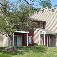
25 Burns Avenue
Some errands can be accomplished on foot.
A few nearby public transportation options.
Flat as a pancake, minimal bike lanes.
About your score
25 Burns Avenue has a Walk Score of 61 out of 100. This location is Somewhat Walkable so some errands can be accomplished on foot.
This location is in Cincinnati. Nearby parks include Village Historic District, Voorhees Park and Hamilton County Fairgrounds.
Explore how far you can travel by car, bus, bike and foot from 25 Burns Avenue.
25 Burns Avenue has some transit which means a few nearby public transportation options.
Bus lines:
5161 Duck Creek - Roselawn
0.1 mi
3371 Ferguson - Bond Hill - Silverton
0.1 mi
2121 Westwood Northern - Madisonville
0.1 mi
3162 Clifton/McMillan - Hartwell
0.1 mi
4361 Seymour - Hartwell
0.1 mi
4061 Jonathan - Paddock - Hartwell
0.1 mi
1161 Madison - Hartwell - Carthage
0.1 mi
1762 Belmont - Hartwell - Bond Hill
0.1 mi
2461 Erie - Bond Hill - Hartwell
0.1 mi
1761 Belmont - Camp Washington - Hartwel
0.1 mi
View all Cincinnati apartments on a map.

Popular apartment searches include hardwood floor, pool and fireplace.
This location is in the city of Cincinnati, OH. Cincinnati has an average Walk Score of 50 and has 296,943 residents.
Cincinnati Music Hall
The Golden Muse
Bogart's


If you are using a screen reader or having trouble reading this website, please call Walk Score customer service at (253) 256-1634.
© 2026 Walk Score