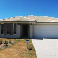
260 Waterford Road

Most errands require a car.

A few nearby public transportation options.

260 Waterford Road has a Walk Score of 49 out of 100. This location is a Car-Dependent neighborhood so most errands require a car.
260 Waterford Road is a 27 minute walk from the IPBR Ipswich line - Brisbane City, the IPCA Ipswich line - Caboolture line and the IPDB Ipswich line - Doomben line at the Gailes station, platform 2 stop.
This location is in the Wacol neighborhood in Brisbane.
Explore how far you can travel by car, bus, bike and foot from 260 Waterford Road.
260 Waterford Road has some transit which means a few nearby public transportation options.
Rail lines:
RWBR Rosewood line - Brisbane City
1.4 km
IPCA Ipswich line - Caboolture line
1.4 km
IPRP Ipswich line - Redcliffe Peninsula Line
1.4 km
RWBD Rosewood line - Airport line
1.4 km
IPDB Ipswich line - Doomben line
1.4 km
IPBR Ipswich line - Brisbane City
1.4 km
IPFG Ipswich line - Ferny Grove line
1.4 km
RWNA Rosewood line - Nambour line
1.4 km
IPNA Ipswich line - Nambour line
1.4 km
RWRP Rosewood line - Redcliffe Peninsula Line
1.4 km
Bus lines:
463 Forest Lake Village - Goodna Station
0.1 km
534 Browns Plains - Orion Springfield Central
0.1 km
R592 Corinda - Ipswich
1.4 km
260 Waterford Road is in the Wacol neighborhood. Wacol is the 279th most walkable neighborhood in Brisbane with a neighborhood Walk Score of 14.



If you are using a screen reader or having trouble reading this website, please call Walk Score customer service at (253) 256-1634.
© 2026 Walk Score