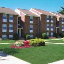
49 Inkberry Road
Most errands require a car.
Score Details
49 Inkberry Road has a Walk Score of 45 out of 100. This location is a Car-Dependent neighborhood so most errands require a car.
This location is in Levittown. Nearby parks include Mill Creek Valley Park, Levittown Public Recreation Association Park and Foster Hollow County Park.
Nearby schools include Immaculate Conception, Oxford Valley Coop Preschool & Kindergarten and Barton Elementary School.
The closest grocery stores are Griffin's Buffalo Wing Sauce, Meat Store and Star Mini Mart.
Nearby coffee shops include Dunkin' Donuts and Good Morning Coffee Services. There are seven restaurants within a 15 minute walk including Mc Stews Irish Sports Pub, Hoagie Xpress and Anthony's Pizza.
Explore how far you can travel by car, bus, bike and foot from 49 Inkberry Road.
Bus lines:
129 Frankford-Knights to Oxford Valley
0.2 mi
Car shares:
View all Levittown apartments on a map.

Popular apartment searches include fireplace and hardwood floor.
This location is in the city of Levittown, PA. Levittown has an average Walk Score of 35 and has 52,983 residents.
Learn More About Levittown


If you are using a screen reader or having trouble reading this website, please call Walk Score customer service at (253) 256-1634.
© 2025 Walk Score