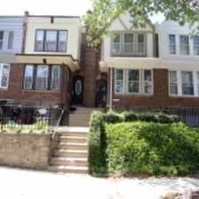
6516 N Uber St
Most errands can be accomplished on foot.
Many nearby public transportation options.
Flat as a pancake, excellent bike lanes.
Score Details
6516 N Uber St has a Walk Score of 80 out of 100. This location is Very Walkable so most errands can be accomplished on foot.
This location is in the West Oak Lane neighborhood in Philadelphia. Nearby parks include East Germantown Recreation Center, Simons Playground and Simons Recreation Center.
Nearby schools include Kinsey John L School, Mt Airy Christian Day School and Holy Temple of God Christian School.
The closest grocery stores are Jakuaz Grocery, Reyes Grocery and Espinal Ramos Grocery.
Nearby coffee shops include Sugafoot Cafe', Dunkin' Donuts and Dunkin' Donuts. Nearby restaurants include Cho Grill Master Deli Inc, Crown Fried Chicken and Fantastics Banquet Hall.
6516 N Uber St is near Kemble Park, Awbury Arboretum and La Salle University.
There are excellent bike lanes and the terrain is flat as a pancake. 6516 N Uber St is very bikeable, biking is convenient for most trips.
Explore how far you can travel by car, bus, bike and foot from 6516 N Uber St.
6516 N Uber St has good transit which means many nearby public transportation options. Car sharing is available from Zipcar and RelayRides.
Rail lines:
BSS ATT Station to Fern Rock TC
1.1 mi
Chestnut Hill East Line Chestnut Hill East Line
1.1 mi
Warminster Line Warminster Line
1.2 mi
Lansdale/Doylestown Line Lansdale/Doylestown Line
1.2 mi
West Trenton Line West Trenton Line
1.2 mi
Bus lines:
6 Cheltenham-Ogontz to OTC
0.0 mi
K Ridge-Midvale to Arrott TC
0.1 mi
18 Fox Chase to Cedarbrook Plaza
0.1 mi
L Erdenheim/PlymthMtngMall to OTC
0.2 mi
28 Fern Rock TC to Torresdale-Cottman
1.1 mi
BSO Midnight-5am Service (Bus) for BSL
1.1 mi
57 WhitmanPlaza to Fern Rock Trans Ctr
1.1 mi
70 Fkd-Gregg/Torr-Cottmn to FRTC
1.1 mi
Car shares:
6516 N Uber St compared to all of Philadelphia.
Lower crime area.
Lower crime area.
How do you feel walking near 6516 N Uber St?
Day:
Night:
Thanks for your feedback!
View all West Oak Lane apartments on a map.

6516 N Uber St is in the West Oak Lane neighborhood. West Oak Lane is the 45th most walkable neighborhood in Philadelphia with a neighborhood Walk Score of 77.
Moving to Philadelphia from another city? View our moving to Philadelphia guide.
Rowen William School
Ogontz Av & Haines St
66th Av & 17th St


If you are using a screen reader or having trouble reading this website, please call Walk Score customer service at (253) 256-1634.
© 2025 Walk Score