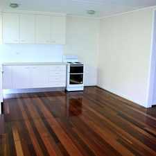
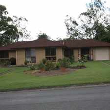
8 Aramac Street

Almost all errands require a car.

It is possible to get on a bus.

8 Aramac Street has a Walk Score of 0 out of 100. This location is a Car-Dependent neighborhood so almost all errands require a car.
This location is in the Brassall neighborhood in Brisbane. Nearby parks include Sutton's Park and Battye Park.
Explore how far you can travel by car, bus, bike and foot from 8 Aramac Street.
8 Aramac Street has minimal transit which means it is possible to get on a bus.
Rail lines:
RBUS Rail Bus SCAS closure
2.0 km
CARW Caboolture line - Rosewood line
2.0 km
BDRW Airport line - Rosewood line
2.0 km
BRRW Brisbane City - Rosewood line
2.0 km
IPRW Ipswich line - Rosewood line
2.0 km
RWBR Rosewood line - Brisbane City
2.0 km
RWBD Rosewood line - Airport line
2.0 km
RWIP Rosewood line - Ipswich line
2.0 km
RWNA Rosewood line - Nambour line
2.0 km
RWCA Rosewood line - Caboolture line
2.0 km
Bus lines:
512 Brassall - Riverlink Shopping Centre
0.8 km
R598 Ipswich all stations - Rosewood
2.0 km
515 Brassall - Yamanto & Willowbank
2.4 km
8 Aramac Street is in the Brassall neighborhood. Brassall is the 223rd most walkable neighborhood in Brisbane with a neighborhood Walk Score of 34.



If you are using a screen reader or having trouble reading this website, please call Walk Score customer service at (253) 256-1634.
© 2026 Walk Score