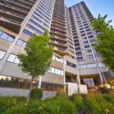
1334 Laurel Park Drive
Most errands can be accomplished on foot.
Many nearby public transportation options.
Flat as a pancake, minimal bike lanes.
Score Details
1334 Laurel Park Drive has a Walk Score of 81 out of 100. This location is Very Walkable so most errands can be accomplished on foot.
This location is in the West End neighborhood in Cincinnati. Nearby parks include Laurel Recreation Area, Laurel Recreation Area and Laurel Homes Historic District.
Nearby schools include Robert A. Taft Information Technology High School, St Joseph School and Cincinnati College Preparatory Academy.
The closest grocery stores are Jet-In Market, L & S Market and Save Way Super Market Inc.
Nearby coffee shops include Cafe Lang Thang, 1215 Wine Bar & Coffee Lab and Bank Cafe. Nearby restaurants include G Jay's Delicatessen & Pony, Richie's Fast Food Restaurant and Symphony Hotel Restaurant.
1334 Laurel Park Drive is near Laurel Recreation Area, Laurel Playground and Lincoln Playground.
There are minimal bike lanes and the terrain is flat as a pancake. 1334 Laurel Park Drive is bikeable, there is some bike infrastructure.
Explore how far you can travel by car, bus, bike and foot from 1334 Laurel Park Drive.
1334 Laurel Park Drive has good transit which means many nearby public transportation options. Car sharing is available from Zipcar and RelayRides.
Bus lines:
1 Museum Center-Mt Adams-Zoo
0.1 mi
49 Queensgate - Fairmount
0.1 mi
16 Mt Healthy - Spring Grove Ave
0.2 mi
27 Northside - Linn Street
0.2 mi
20 Winton Rd/Tri-County
0.2 mi
6 Queen City - Westwood
0.2 mi
Car shares:
1334 Laurel Park Drive is in the West End neighborhood. West End is the 4th most walkable neighborhood in Cincinnati with a neighborhood Walk Score of 77.


If you are using a screen reader or having trouble reading this website, please call Walk Score customer service at (253) 256-1634.
© 2025 Walk Score