


Search for apartments in East Harlem or apartments in New York, or check out apartments in other New York neighborhoods. Links will open on our partner site Redfin.com.
- Astoria, New York apartments for rent
- Bayside, New York apartments for rent
- Brooklyn, New York apartments for rent
- Flushing, New York apartments for rent
- Forest Hills, New York apartments for rent
- Jamaica, New York apartments for rent
- Little Neck, New York apartments for rent
- Long Island City, New York apartments for rent
- Maplewood, New York apartments for rent
- Park Slope, New York apartments for rent
- Queens, New York apartments for rent
- Queens Village, New York apartments for rent
- Rego Park, New York apartments for rent
- Riverdale, New York apartments for rent
- Staten Island, New York apartments for rent
- Upper East Side, New York apartments for rent
- Upper West Side, New York apartments for rent
- West Village, New York apartments for rent
- Whitestone, New York apartments for rent
- Williamsburg, New York apartments for rent


 #eastharlem a beautiful church across from Thomas Jefferson Park and Recreational Center- has services daily.
  #eastharlem hole in the wall bar and music venue in East Harlem- cash only, and an eclectic crowd of tourists, and locals.
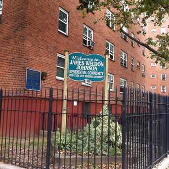
  #eastHarlem the James Weldon Johnson community and residential living center provide health care and supervision for special needs adults, and the elderly. There is also a healthcare center, and early childhood center on the property.


Kalli Meisler
on Our Lady Queen Of Angels School