Walk Score Logo
Go
Locate me

Living in Fort Collins

Fort Collins has an average Walk Score of 37 with 143,986 residents.

Fort Collins has some public transportation and is very bikeable.

The most walkable Fort Collins neighborhoods are Downtown, Old Town and University Park.

Nearby Fort Collins Apartments on Redfin

37 Walk Score of Fort Collins, CO

Fort Collins is a Car-Dependent city

Most errands require a car.

Walk Score Map

25
100
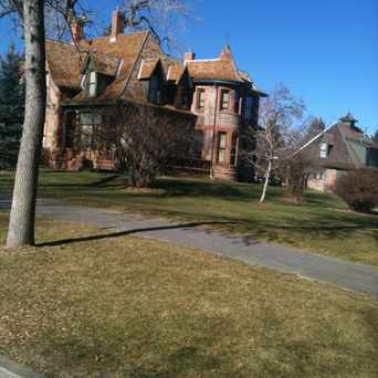
Photo of Fort Collins Senior Center in Fort Collins

Fort Collins Senior Center

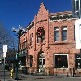
Photo of Rock And Stone Business in Fort Collins

Rock And Stone Business

Most errands require a car in Fort Collins.

Fort Collins Apartments for Rent

Fort Collins Neighborhoods

Rank

#

Name

Walk Score

Transit Score

Bike Score

Population

1 Downtown 90 48 100 1,118
2 Old Town 85 44 100 627
3 University Park 78 46 100 1,892
4 University North 76 51 99 1,504
5 Old Prospect 70 40 99 786
6 Old Town West 68 45 97 1,703
7 Warren Farms 67 39 93 607
8 City Park Heights 66 45 95 1,030
9 Historic Fort Collins High School 66 44 99 1,169
10 Martinez Park 65 41 94 675
11 South College Heights 65 39 98 914
12 University Acres 59 27 95 929
13 Golden Meadows 59 25 90 1,064
14 Prospect-Shields 58 41 91 3,386
15 Meadowlark 56 42 92 1,028
16 Prospect at Spring Meadows 55 29 91 635
17 Thunderbird East 55 38 95 625
18 Rams Village 54 43 94 795
19 South Sheldon Lake 54 43 90 772
20 Woodwest 54 38 91 1,804
21 The Landings 52 31 85 1,398
22 Lake Street Homes 52 46 96 1,004
23 City Park 51 34 90 1,152
24 Meadows East 51 20 83 550
25 Capitol Hill 50 32 88 839
26 Harmony Park 50 25 71 975
27 Highlander Heights 48 24 92 1,070
28 Indian Hills 47 31 90 681
29 Troutman Park 46 37 87 4,057
30 Scotch Pines 46 30 93 1,004
31 Side Hill 46 20 85 531
32 Avery Park 44 40 91 1,511
33 Foxstone 43 22 72 1,862
34 Moore 40 40 88 673
35 Southmoor Village 40 27 86 1,117
36 English Ranch 37 21 71 1,646
37 Oakridge Village 37 22 74 952
38 Cottonwood 37 31 88 643
39 Rigden Farm 37 19 80 1,727
40 Village West 36 27 86 701
41 Village East 34 26 79 550
42 Foothills Green 34 31 81 1,556
43 Westfield Park 33 24 81 635
44 Lake Sherwood Corporation 33 23 80 1,352
45 Wagon Wheel 32 25 80 1,045
46 Rogers Park 31 36 82 2,888
47 Parkwood 30 24 80 826
48 P.O.E.T 30 35 82 2,808
49 Silver Plume 30 25 76 575
50 Timber Creek 30 23 67 599
51 Nelson Farm 29 23 78 1,089
52 Willow Park 29 35 82 882
53 Brown Farm 28 21 76 2,563
54 Miramont 26 19 68 1,265
55 Collindale 26 22 79 864
56 Parkwood East 24 23 82 1,140
57 Dakota Ridge 24 21 72 982
58 Woodridge 23 20 78 1,326
59 Harvest Park 23 23 66 1,127
60 Willow Springs 23 10 67 1,550
61 Stetson Creek 22 21 63 713
62 Huntington Hills 22 19 72 1,245
63 Rossborough 21 23 76 1,072
64 Stone Ridge 20 20 69 691
65 Evergreen 19 23 81 620
66 Mulberry Hill 18 29 76 601
67 Fairbrooke 17 28 71 1,040
68 Sage Creek 14 22 57 613
69 Observatory Village 13 23 62 1,000
70 Quail Hollow 13 3 72 859
71 Westwood 12 27 67 657
72 Paragon Point 10 - 63 563
73 Westgate 9 26 61 557
74 Ridgewood Hills 9 20 36 1,889
75 Ponds at Overland 7 28 54 700
76 Westchase 7 - 52 1,700
77 Maple Hill 6 - 54 608
78 Provincetowne 6 8 61 1,250
79 Clarendon Hills 5 28 53 688
80 Fossil Lake 4 12 48 1,974
81 Stanton Creek 4 - 60 801
82 Waterglen 2 18 50 1,365

Eating & Drinking

There are about 521 restaurants, bars and coffee shops in Fort Collins.

People in Fort Collins can walk to an average of 0.4 restaurants, bars and coffee shops in 5 minutes.

Restaurant Choices Map

= More Choices

28 Transit Score of Fort Collins, CO

Fort Collins has Some Transit

A few nearby public transportation options. Find Fort Collins apartments for rent on Redfin.

Public Transit Routes

Fort Collins has some public transportation and about 21 bus lines.

Transit Time

The map above shows how far you can travel in 30 minutes from Fort Collins on public transit.

78 Bike Score of Fort Collins, CO

Fort Collins is Very Bikeable

Biking is convenient for most trips.

25
100
Bike
Score

     o__
    _.>/ _
___(_)_\(_)___
          
Bike
Lanes

________________
 __  __  __  __
________________
          
Hills
          _
         / \
   _   _/   \
__/ \_/      \__
          
Bike
Commuters
              _
             |_|
/\           |_|
[]...........|_|
          

Photo of Rock And Stone Business in Fort Collins

Rock And Stone Business

Photo of Rock And Stone Business in Fort Collins

Rock And Stone Business

Photo of Rock And Stone Business in Fort Collins

Rock And Stone Business

Photo of Fort Collins City Park in Fort Collins

Fort Collins City Park

Photo of Fort Collins City Park in Fort Collins

Fort Collins City Park

Photo of Fort Collins City Park in Fort Collins

Fort Collins City Park

Photo of Aggie Theatre in Fort Collins

Aggie Theatre

Photo of Avery House in Fort Collins

Avery House

Photo of Old Town Square in Fort Collins

Old Town Square

Photo of Rock And Stone Business in Fort Collins

Rock And Stone Business

Fort Collins is Talking About...

college play colorado coffee job god team foco school class food beer sleep party car csu movie drinking walk eat

Fort Collins is all about:

Tweet @WalkScore
Photo of Rock And Stone Business in Fort Collins

Rock And Stone Business

Photo of Rock And Stone Business in Fort Collins

Rock And Stone Business

Photo of Rock And Stone Business in Fort Collins

Rock And Stone Business

Photo of Mountain Avenue Market in Fort Collins

Mountain Avenue Market

Walk Score Professional

Real Estate

Walk Score Neighborhood Map

Add Walk Score, Bike Score, and Transit Score to your rental and for sale properties with the Walk Score Widget.

Software Developers

Walk Score APIs

Build apps with Walk Score, public transit data, and commute and travel times via Walk Score APIs.

Data and Analysis

Walk Score Data and Research

Use Walk Score data for real estate, public health, finance, and urban planning research and analysis.