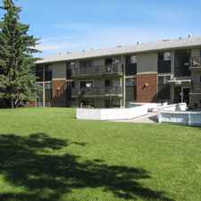
32 Winchester Crescent Southwest
Commute to Downtown Calgary

Most errands require a car.

Many nearby public transportation options.

Flat as a pancake, excellent bike lanes.
About your score
32 Winchester Crescent Southwest has a Walk Score of 49 out of 100. This location is a Car-Dependent neighborhood so most errands require a car.
32 Winchester Crescent Southwest is an eight minute walk from the 202 Blue Line - Saddletowne / 69 Street CTrain at the WB 45 Street CTrain Station stop.
This location is in the Westgate neighborhood in Calgary. Nearby parks include Optimist Athletic Park, Strathcona Park and Playground.
Explore how far you can travel by car, bus, bike and foot from 32 Winchester Crescent Southwest.
32 Winchester Crescent Southwest has good transit which means many nearby public transportation options.
Rail lines:
202 Blue Line - Saddletowne / 69 Street CTrain
0.5 km
Bus lines:
93 Coach Hill / Westbrook
0.1 km
795 Vincent Massey/ Strathcona
0.1 km
412 Bow Trail
0.3 km
699 West Springs/various schools
0.5 km
698 17th Ave/Western Canada/St. Mary's
0.5 km
2 Mt. Pleasant / Killarney 17 Ave.
0.5 km
32 Winchester Crescent Southwest is in the Westgate neighborhood. Westgate is the 88th most walkable neighborhood in Calgary with a neighborhood Walk Score of 52.




If you are using a screen reader or having trouble reading this website, please call Walk Score customer service at (253) 256-1634.
© 2026 Walk Score