3629 Liberty Heights Avenue
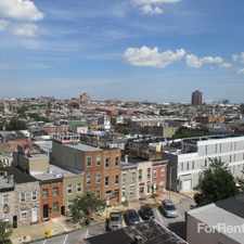
Forest Park, Baltimore, 21215
Commute to Downtown Lochearn
Some errands can be accomplished on foot.
Many nearby public transportation options.
Flat as a pancake, minimal bike lanes.
About your score
3629 Liberty Heights Avenue has a Walk Score of 59 out of 100. This location is Somewhat Walkable so some errands can be accomplished on foot.
This location is in the Forest Park neighborhood in Baltimore. Nearby parks include Liberty Recreation Center, Hanlon Park and Carlins Park (historical).
Explore how far you can travel by car, bus, bike and foot from 3629 Liberty Heights Avenue.
3629 Liberty Heights Avenue has good transit which means many nearby public transportation options.
Rail lines:
METRO METRO
0.8 mi
Bus lines:
052 MILFORD MILL RD-MONDAWMIN STAT
0.0 mi
038 NORTH BEND-COLD SPRING & GRANDVIEW
0.0 mi
091 SINAI HOSPITAL - DOWNTOWN
0.2 mi
3629 Liberty Heights Avenue compared to all of Baltimore.
Lower crime area.
Average crime area.
How do you feel walking near 3629 Liberty Heights Avenue?
Day:
Night:
Thanks for your feedback!
3629 Liberty Heights Avenue is in the Forest Park neighborhood. Forest Park is the 132nd most walkable neighborhood in Baltimore with a neighborhood Walk Score of 63.
Moving to Baltimore from another city? View our moving to Baltimore guide.


If you are using a screen reader or having trouble reading this website, please call Walk Score customer service at (253) 256-1634.
© 2025 Walk Score